Land/Building » Tokai » Aichi Prefecture » Nagoya City Midori-ku
| | Nagoya, Aichi Prefecture Midori Ward 愛知県名古屋市緑区 |
| JR Tokaido Line "Minami Odaka" walk 17 minutes JR東海道本線「南大高」歩17分 |
| Ground survey ・ Exterior work included, Amount of money 32,950,000 yen. Popular Otaka south. Floor plan, Expanding change in total floor area of 104.22 sq m (31.52 square meters). 地盤調査・外構工事 込み、金額3295万円。 人気の大高南。間取り、延床面積104.22m2(31.52坪)に拡大変更。 |
Features pickup 特徴ピックアップ | | Super close / Yang per good / Siemens south road / A quiet residential area / Or more before road 6m / Corner lot / Leafy residential area / City gas / Maintained sidewalk / Readjustment land within スーパーが近い /陽当り良好 /南側道路面す /閑静な住宅地 /前道6m以上 /角地 /緑豊かな住宅地 /都市ガス /整備された歩道 /区画整理地内 | Price 価格 | | 32,950,000 yen 3295万円 | Building coverage, floor area ratio 建ぺい率・容積率 | | Fifty percent ・ 150% 50%・150% | Sales compartment 販売区画数 | | 1 compartment 1区画 | Land area 土地面積 | | 94.46 sq m (28.57 tsubo) (measured) 94.46m2(28.57坪)(実測) | Driveway burden-road 私道負担・道路 | | Nothing, East 6m width (contact the road width 10m), South 6m width (contact the road width 10m) 無、東6m幅(接道幅10m)、南6m幅(接道幅10m) | Land situation 土地状況 | | Vacant lot 更地 | Address 住所 | | Nagoya, Aichi Prefecture Midori-ku Otaka-cho ship human hair pond 愛知県名古屋市緑区大高町字船人ケ池 | Traffic 交通 | | JR Tokaido Line "Minami Odaka" walk 17 minutes
JR Tokaido Line "Republic" walk 18 minutes JR東海道本線「南大高」歩17分
JR東海道本線「共和」歩18分
| Related links 関連リンク | | [Related Sites of this company] 【この会社の関連サイト】 | Contact お問い合せ先 | | (Ltd.) Otaka land TEL: 0800-603-1816 [Toll free] mobile phone ・ Also available from PHS
Caller ID is not notified
Please contact the "saw SUUMO (Sumo)"
If it does not lead, If the real estate company (株)大高土地TEL:0800-603-1816【通話料無料】携帯電話・PHSからもご利用いただけます
発信者番号は通知されません
「SUUMO(スーモ)を見た」と問い合わせください
つながらない方、不動産会社の方は
| Land of the right form 土地の権利形態 | | Ownership 所有権 | Building condition 建築条件 | | With 付 | Time delivery 引き渡し時期 | | Consultation 相談 | Land category 地目 | | Residential land 宅地 | Use district 用途地域 | | One low-rise 1種低層 | Other limitations その他制限事項 | | Height district 高度地区 | Overview and notices その他概要・特記事項 | | Facilities: Public Water Supply, This sewage, City gas 設備:公営水道、本下水、都市ガス | Company profile 会社概要 | | <Seller> Governor of Aichi Prefecture (6) No. 014762 (Ltd.) Otaka land Yubinbango459-8001 Nagoya, Aichi Prefecture Midori-ku Otaka-cho Tsuruta 54-1 <売主>愛知県知事(6)第014762号(株)大高土地〒459-8001 愛知県名古屋市緑区大高町字鶴田54-1 |
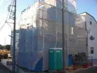
Local land photo現地土地写真  Local (January 2014) Shooting
現地(2014年1月)撮影
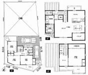
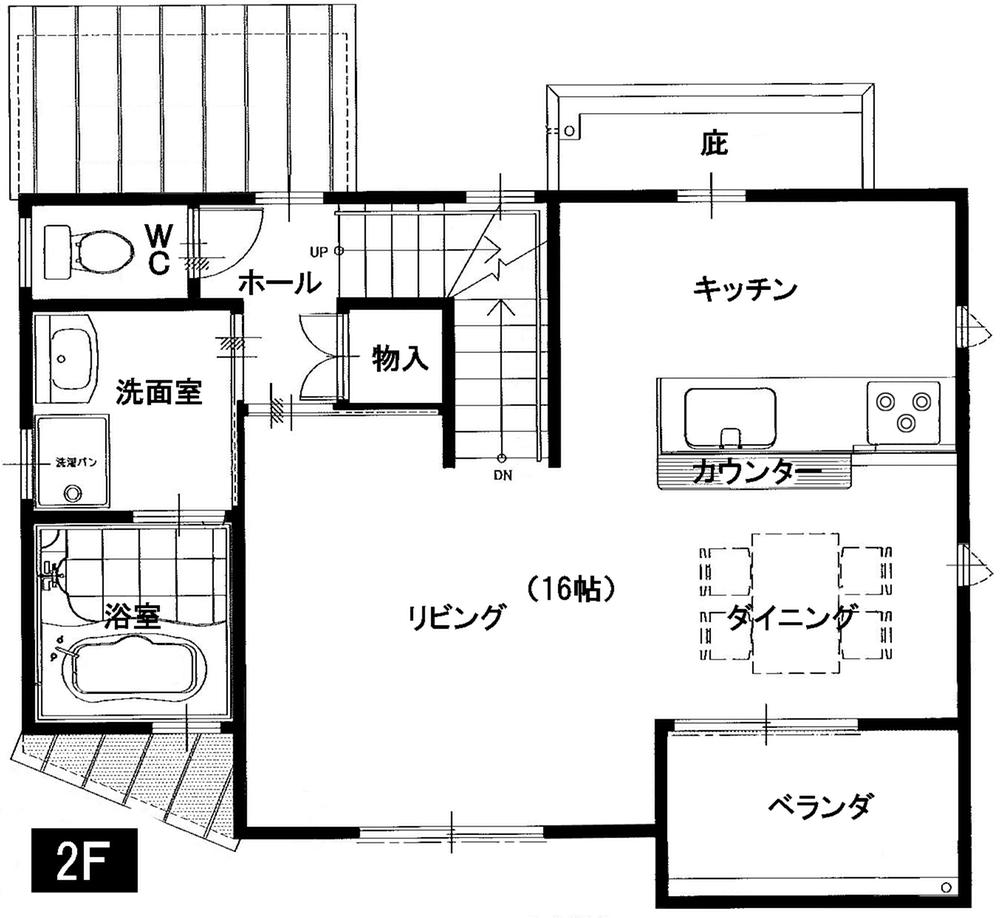
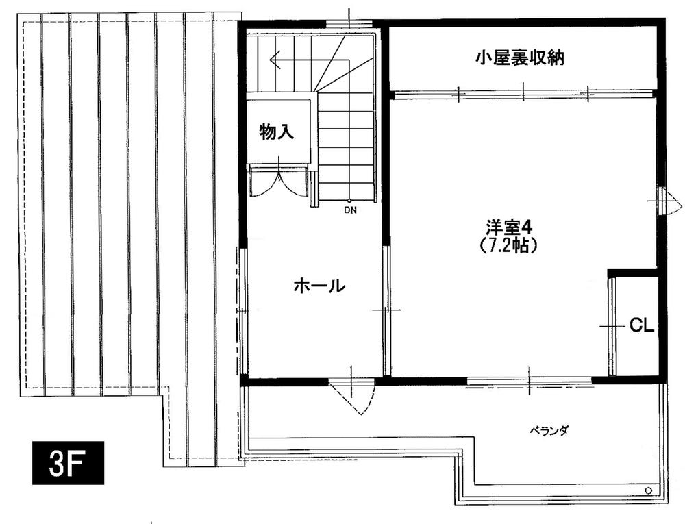
Building plan example (floor plan)建物プラン例(間取り図) 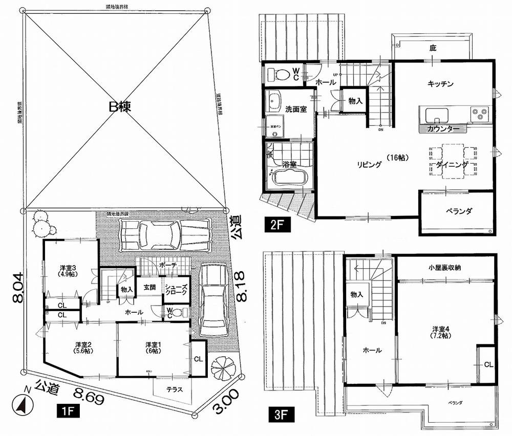 1F 43.00 sq m 2F 40.08 sq m 3F 21.14 sq m Total floor area of 104.22 sq m
1F 43.00m2
2F 40.08m2
3F 21.14m2
延床面積104.22m2
Otherその他 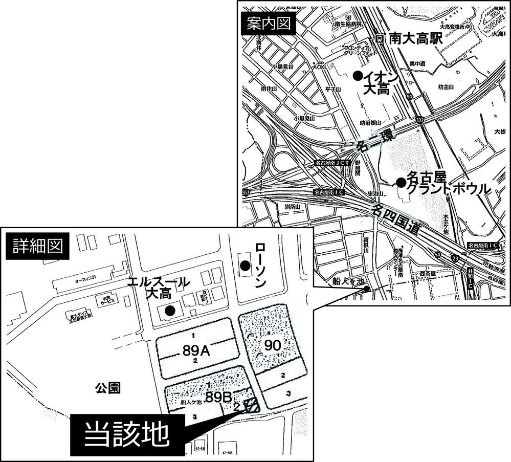 Information map
案内図
Compartment figure区画図 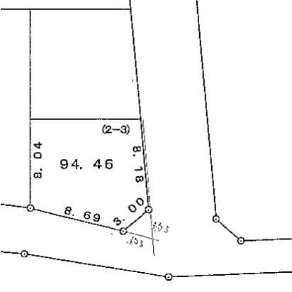 Land price 32,950,000 yen, Land area 94.46 sq m public view
土地価格3295万円、土地面積94.46m2 公図
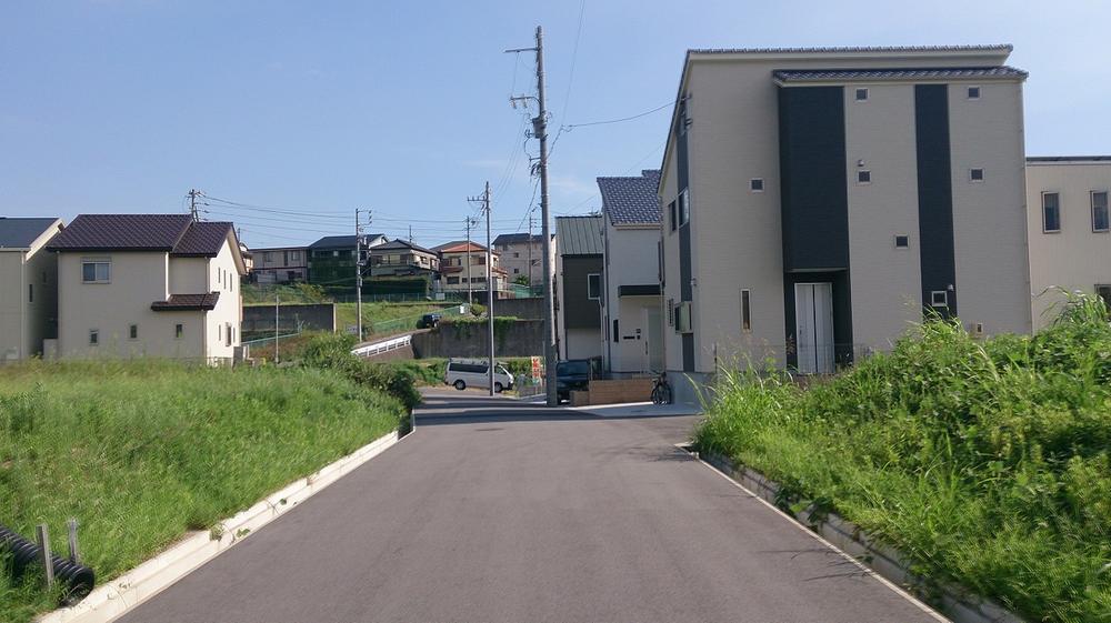 Local photos, including front road
前面道路含む現地写真
Building plan example (exterior photos)建物プラン例(外観写真) 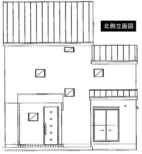 Elevation
立面図
Supermarketスーパー 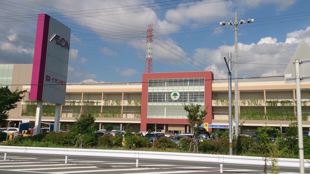 900m until ion Otaka shop
イオン大高店まで900m
Otherその他 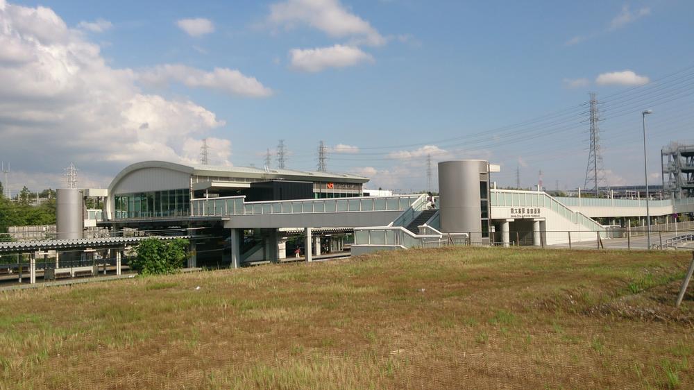 Near JR Otaka South Station Walk 12 to about
周辺 JR大高南駅 徒歩12約
Convenience storeコンビニ 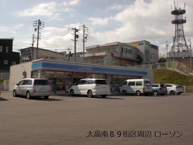 100m until Lawson green-ku, Otaka-cho shop
ローソン緑区大高町店まで100m
Otherその他  Around Otaka junior high school Walk about 20 minutes
周辺 大高中学校 徒歩約20分
Primary school小学校 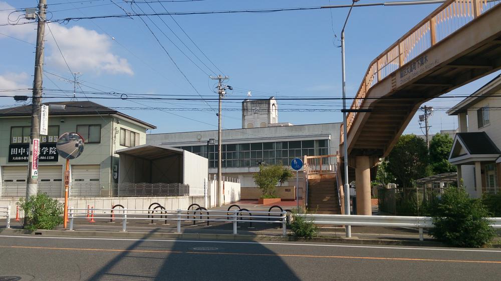 Nagoyashiritsudai 1800m to high Minami Elementary School
名古屋市立大高南小学校まで1800m
Kindergarten ・ Nursery幼稚園・保育園 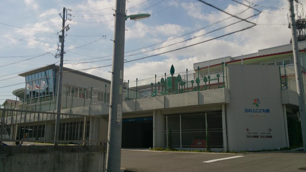 150m to the nursery on the upper children Garden hill of certification hill
認定丘の上こども園丘の上保育園まで150m
Hospital病院 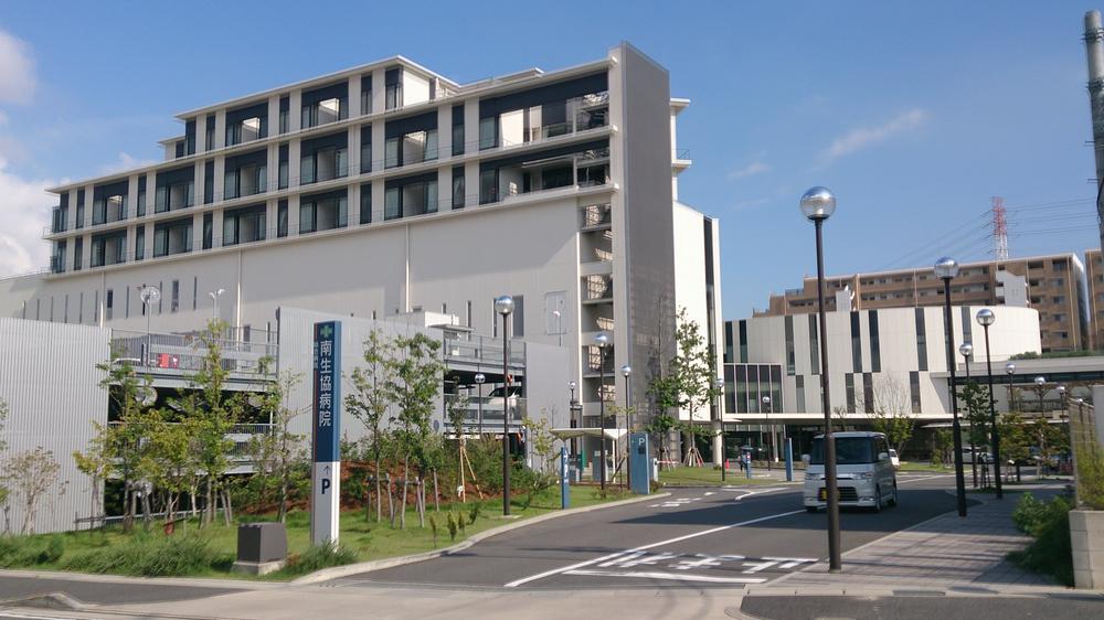 South medical co-op General Hospital until Minamiseikyobyoin 1643m
南医療生活協同組合総合病院南生協病院まで1643m
Park公園 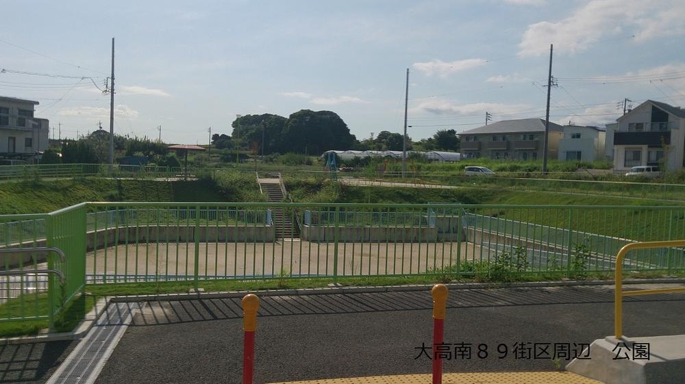 71m to Mizushi pond park
水主池公園まで71m
Otherその他 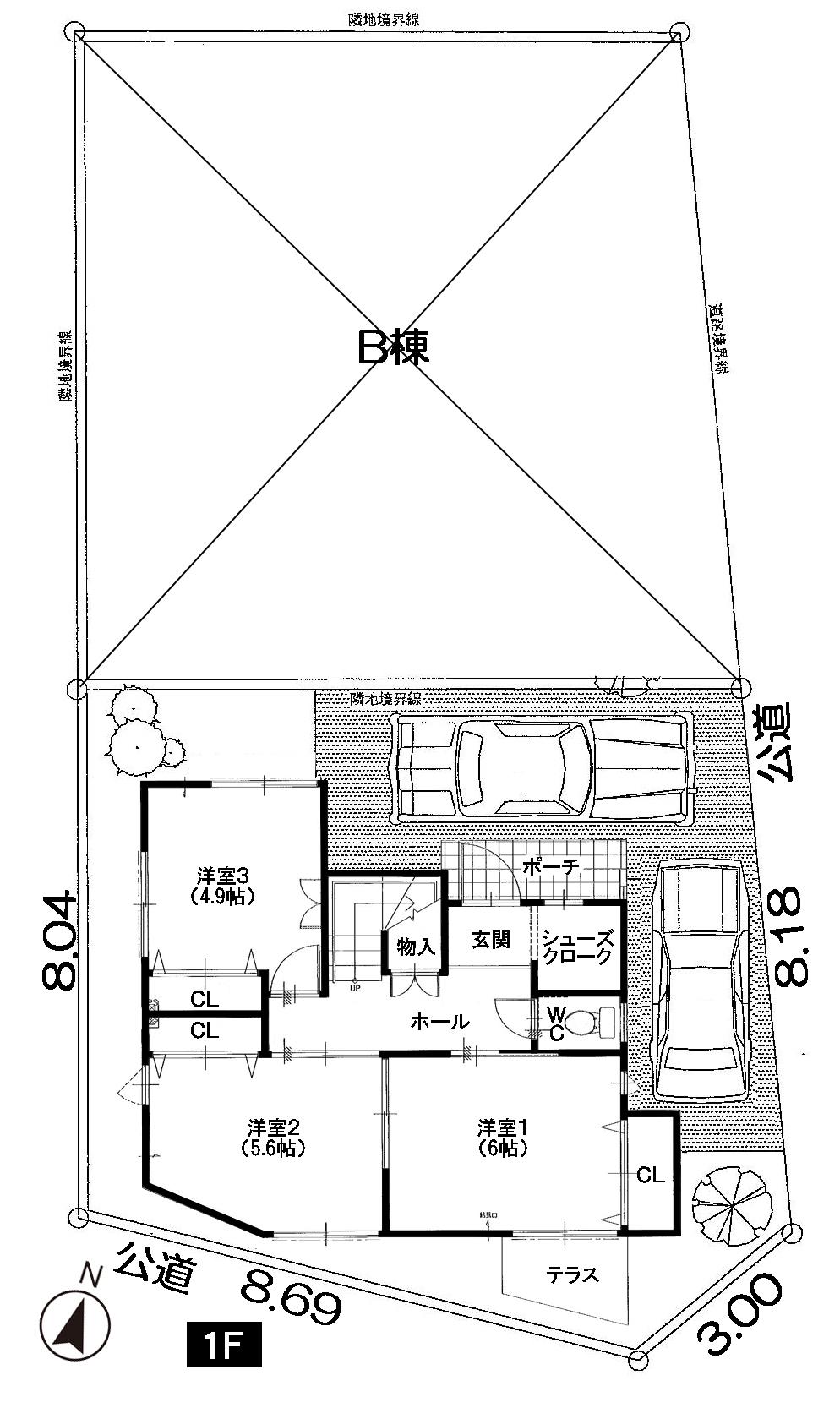 1F 43.00 sq m
1F 43.00m2
 2F 40.08 sq m
2F 40.08m2
 3F 21.14 sq m
3F 21.14m2
Location
|