Land/Building » Kanto » Gunma Prefecture » Isesaki
| | Isesaki, Gunma Prefecture 群馬県伊勢崎市 |
| JR Ryomo "National" car 5.1km JR両毛線「国定」車5.1km |
| Located in a quiet residential area is one section of the old subdivision. There is no building conditions. [I'm Legal] In you can take your advice from financial planning. Please feel free to ask. 閑静な住宅地にある旧分譲地の1区画です。建築条件はありません。【あいむほうむ】では資金計画からご相談をお受けできます。お気軽にお尋ねください。 |
| Located in a quiet residential area is one section of the old subdivision. And agricultural settlement drainage is piping on the front road, Since it is not necessary to install a septic tank can be suppressed cheaper construction costs. 閑静な住宅街にある旧分譲地の1区画です。農業集落排水が前面道路に配管されており、浄化槽を設置しなくても良いので建築費を安く抑えることができます。 |
Features pickup 特徴ピックアップ | | Land 50 square meters or more / Immediate delivery Allowed / A quiet residential area / Around traffic fewer / Shaping land / No construction conditions / Flat terrain / Development subdivision in 土地50坪以上 /即引渡し可 /閑静な住宅地 /周辺交通量少なめ /整形地 /建築条件なし /平坦地 /開発分譲地内 | Price 価格 | | 4.5 million yen 450万円 | Building coverage, floor area ratio 建ぺい率・容積率 | | 70% ・ 200% 70%・200% | Sales compartment 販売区画数 | | 1 compartment 1区画 | Land area 土地面積 | | 189.09 sq m (57.19 tsubo) (Registration) 189.09m2(57.19坪)(登記) | Driveway burden-road 私道負担・道路 | | Share interests 343 sq m × (25 / 343), Northwest 5m width, Southeast 4m width 共有持分343m2×(25/343)、北西5m幅、南東4m幅 | Land situation 土地状況 | | Vacant lot 更地 | Address 住所 | | Isesaki, Gunma Prefecture Akahori Imai-cho 2-1067-234 群馬県伊勢崎市赤堀今井町2-1067-234 | Traffic 交通 | | JR Ryomo "National" car 5.1km JR両毛線「国定」車5.1km
| Related links 関連リンク | | [Related Sites of this company] 【この会社の関連サイト】 | Person in charge 担当者より | | Rep Kobayashi 担当者小林 | Contact お問い合せ先 | | I'm Legal TEL: 0800-809-8269 [Toll free] mobile phone ・ Also available from PHS
Caller ID is not notified
Please contact the "saw SUUMO (Sumo)"
If it does not lead, If the real estate company あいむほうむTEL:0800-809-8269【通話料無料】携帯電話・PHSからもご利用いただけます
発信者番号は通知されません
「SUUMO(スーモ)を見た」と問い合わせください
つながらない方、不動産会社の方は
| Land of the right form 土地の権利形態 | | Ownership 所有権 | Time delivery 引き渡し時期 | | Immediate delivery allowed 即引渡し可 | Land category 地目 | | Residential land 宅地 | Use district 用途地域 | | Unspecified 無指定 | Other limitations その他制限事項 | | Regulations have by the Law for the Protection of Cultural Properties, Special use restricted area 文化財保護法による規制有、特別用途制限地域 | Overview and notices その他概要・特記事項 | | Contact: Kobayashi, Facilities: Public Water Supply 担当者:小林、設備:公営水道 | Company profile 会社概要 | | <Mediation> Gunma Prefecture Governor (1) Article 007 047 No. I'm Legal Yubinbango370-1113 Gunma Prefecture Sawa District Tamamura Oaza box stone 12-11 <仲介>群馬県知事(1)第007047号あいむほうむ〒370-1113 群馬県佐波郡玉村町大字箱石12-11 |
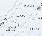
The entire compartment Figure全体区画図 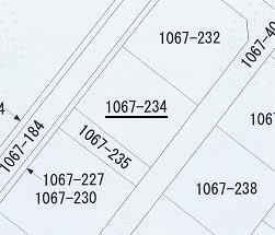 Public figure. 2 side is the road (northwest and southeast)
公図。2面道路です(北西と南東)
Otherその他 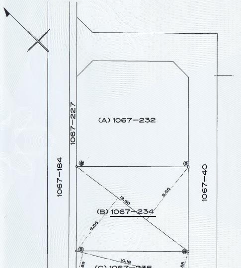 Survey map
測量図
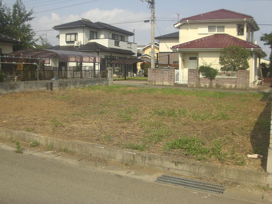
Local land photo現地土地写真 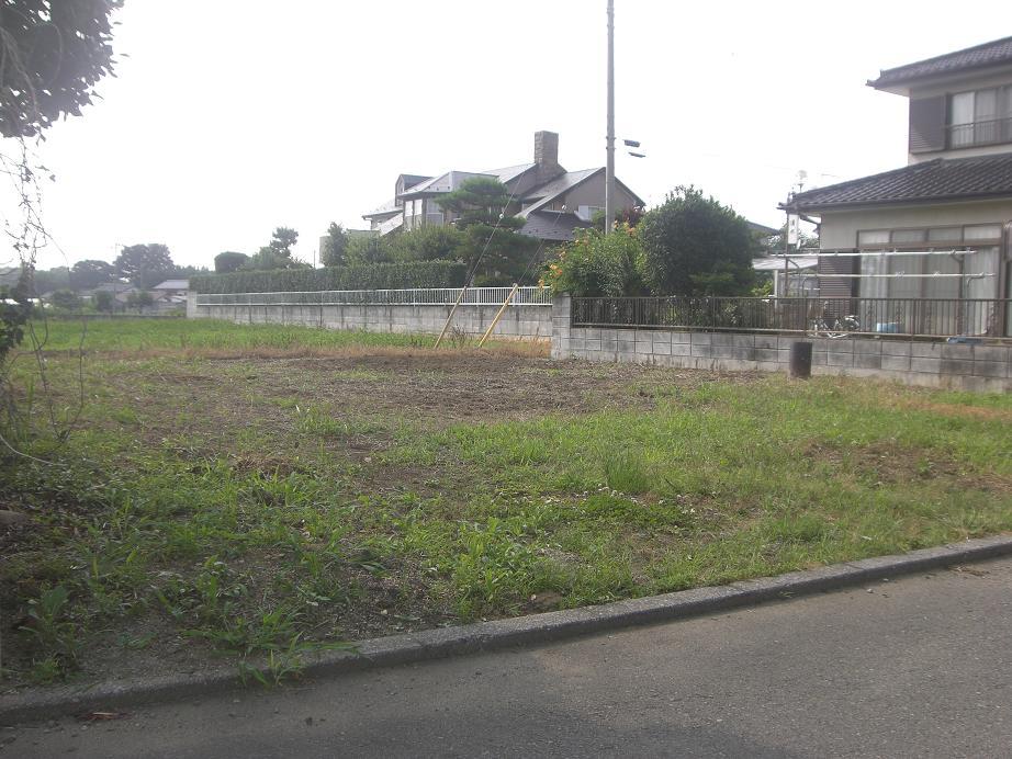 Local (July 2011) shooting. It has taken from the southeast side of the road.
現地(2011年7月)撮影。南東道路側から撮影しています。
 Local (July 2011) shooting. It has taken from the northwest side of the road.
現地(2011年7月)撮影。北西道路側から撮影しています。
Local photos, including front road前面道路含む現地写真 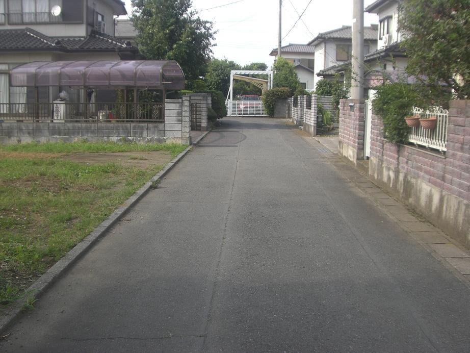 Local (July 2011) shooting. Southeast road.
現地(2011年7月)撮影。南東道路。
Shopping centreショッピングセンター 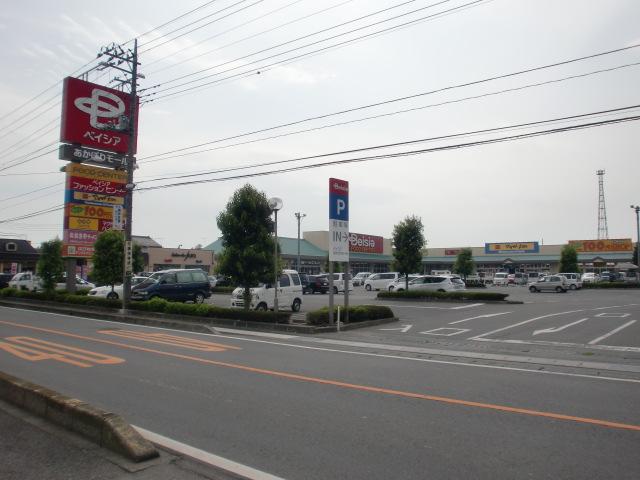 Beisia Akahori until Mall 2879m
ベイシアあかぼりモールまで2879m
Other localその他現地 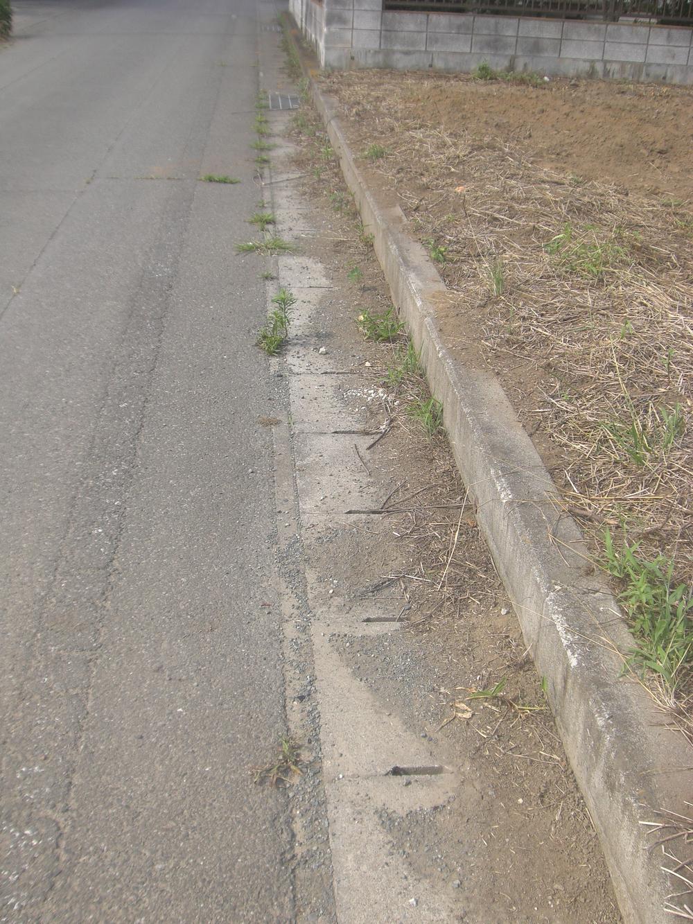 Local (July 2011) shooting. Ditch northwest road.
現地(2011年7月)撮影。北西道路の側溝。
Local photos, including front road前面道路含む現地写真 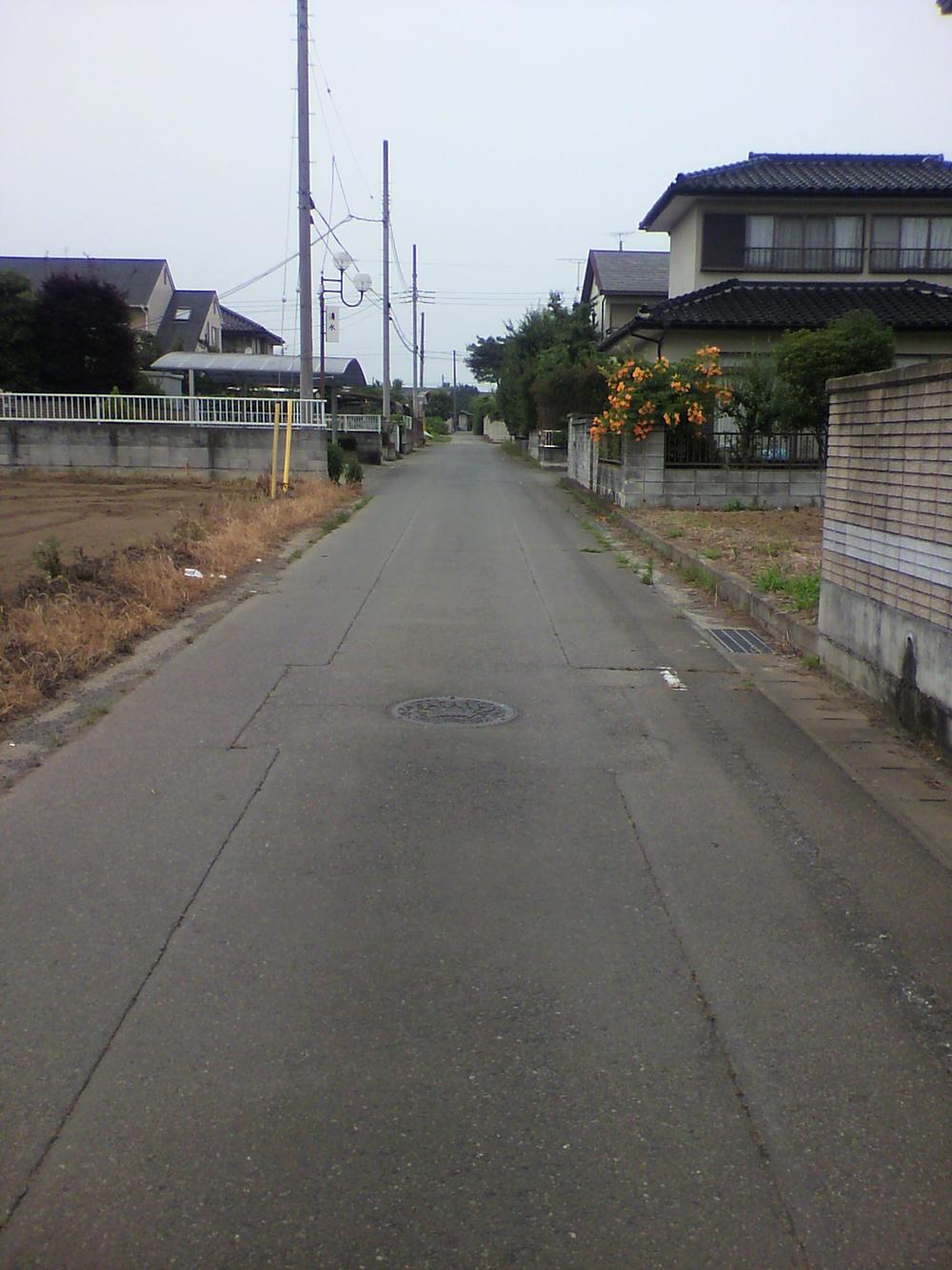 Local (July 2011) shooting. Northwest road.
現地(2011年7月)撮影。北西道路。
Home centerホームセンター 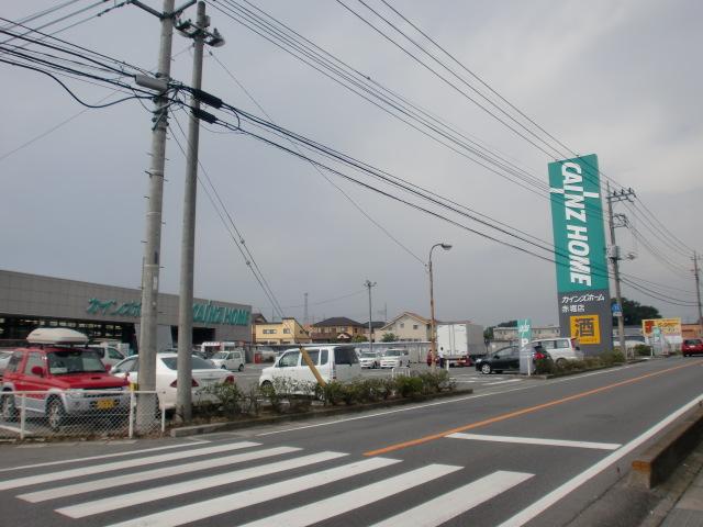 Cain Home Akahori to the store 3260m
カインズホーム赤堀店まで3260m
Location
|