|
|
Sapporo, Hokkaido, Minami-ku,
北海道札幌市南区
|
|
Teitetsu "Misumai" walk 8 minutes
定鉄「簾舞」歩8分
|
|
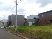
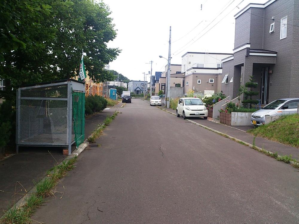
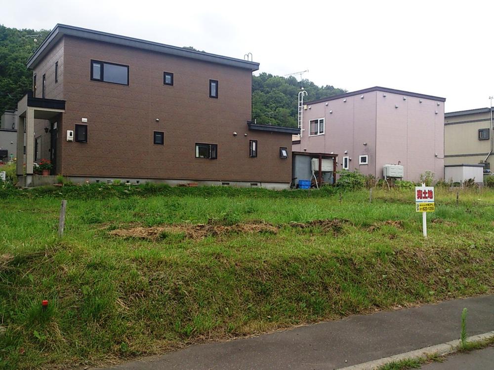
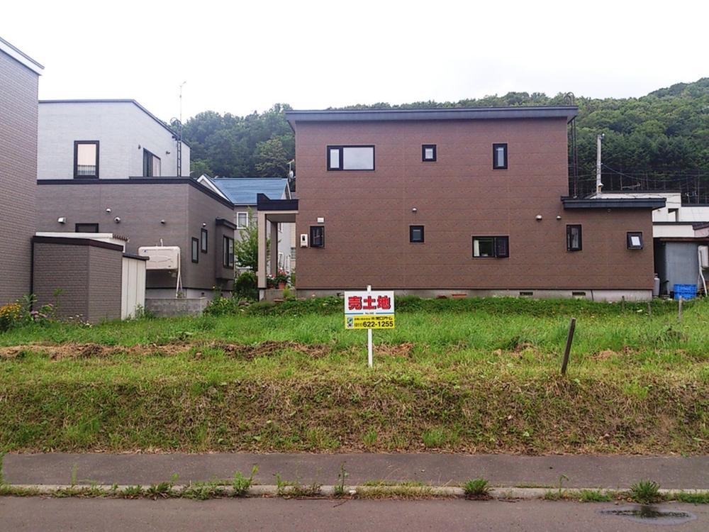
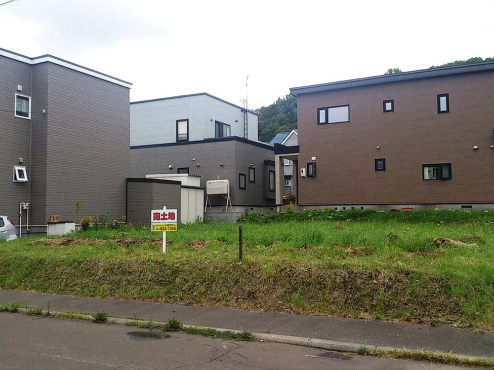
Land 50 square meters or more, Immediate delivery Allowed, See the mountain, A quiet residential area, Around traffic fewer, Or more before road 6m, Leafy residential area, Mu front building, Maintained sidewalk
土地50坪以上、即引渡し可、山が見える、閑静な住宅地、周辺交通量少なめ、前道6m以上、緑豊かな住宅地、前面棟無、整備された歩道
|
|
Land 50 square meters or more, Immediate delivery Allowed, See the mountain, A quiet residential area, Around traffic fewer, Or more before road 6m, Leafy residential area, Mu front building, Maintained sidewalk
土地50坪以上、即引渡し可、山が見える、閑静な住宅地、周辺交通量少なめ、前道6m以上、緑豊かな住宅地、前面棟無、整備された歩道
|
Features pickup 特徴ピックアップ | | Land 50 square meters or more / Immediate delivery Allowed / See the mountain / A quiet residential area / Around traffic fewer / Or more before road 6m / Leafy residential area / Mu front building / Maintained sidewalk 土地50坪以上 /即引渡し可 /山が見える /閑静な住宅地 /周辺交通量少なめ /前道6m以上 /緑豊かな住宅地 /前面棟無 /整備された歩道 |
Price 価格 | | 2.8 million yen 280万円 |
Building coverage, floor area ratio 建ぺい率・容積率 | | 40% ・ 80% 40%・80% |
Sales compartment 販売区画数 | | 1 compartment 1区画 |
Land area 土地面積 | | 210 sq m (registration) 210m2(登記) |
Driveway burden-road 私道負担・道路 | | Nothing, Northwest 8m width (contact the road width 14m) 無、北西8m幅(接道幅14m) |
Land situation 土地状況 | | Vacant lot 更地 |
Address 住所 | | Sapporo, Hokkaido, Minami-ku, Misumaishijo 6 北海道札幌市南区簾舞四条6 |
Traffic 交通 | | Teitetsu "Misumai" walk 8 minutes 定鉄「簾舞」歩8分 |
Contact お問い合せ先 | | TEL: 0800-603-1718 [Toll free] mobile phone ・ Also available from PHS
Caller ID is not notified
Please contact the "saw SUUMO (Sumo)"
If it does not lead, If the real estate company TEL:0800-603-1718【通話料無料】携帯電話・PHSからもご利用いただけます
発信者番号は通知されません
「SUUMO(スーモ)を見た」と問い合わせください
つながらない方、不動産会社の方は
|
Land of the right form 土地の権利形態 | | Ownership 所有権 |
Time delivery 引き渡し時期 | | Immediate delivery allowed 即引渡し可 |
Land category 地目 | | Residential land 宅地 |
Use district 用途地域 | | One low-rise 1種低層 |
Other limitations その他制限事項 | | Regulations have by the Landscape Act, Height ceiling Yes, Setback Yes 景観法による規制有、高さ最高限度有、壁面後退有 |
Overview and notices その他概要・特記事項 | | Facilities: Public Water Supply, This sewage, Individual LPG 設備:公営水道、本下水、個別LPG |
Company profile 会社概要 | | <Mediation> Governor of Hokkaido Ishikari (1) No. 007934 (Ltd.) normal mouth Atom Sapporo Nishiten real estate brokerage sales department Yubinbango063-0812 Hokkaido Sapporo city west district Kotoninijo 2-1-10 in particular N building second floor <仲介>北海道知事石狩(1)第007934号(株)常口アトム札幌西店 不動産売買仲介営業部〒063-0812 北海道札幌市西区琴似二条2-1-10 ことにNビル2階 |