|
|
Kanagawa Prefecture, Nishi-ku, Yokohama-shi
神奈川県横浜市西区
|
|
JR Tokaido Line "Yokohama" walk 7 minutes
JR東海道本線「横浜」歩7分
|
|
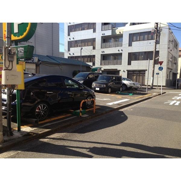
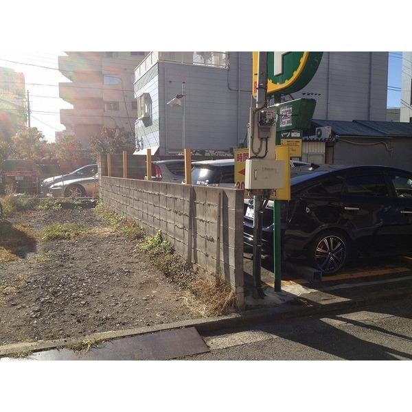
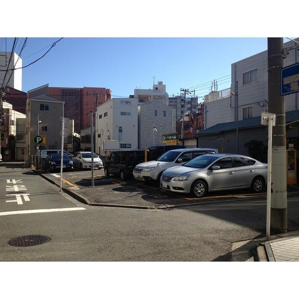
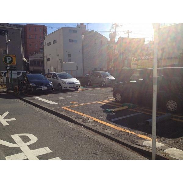
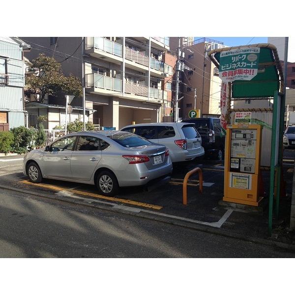
JR each line "Yokohama Station" 7 minutes walk, Is up and running as Sotetsu Line "Yokohama Station" 7 minutes walk from the current state hourly parking
JR各線「横浜駅」徒歩7分、相鉄線「横浜駅」徒歩7分現況時間貸し駐車場として稼働中です
|
Features pickup 特徴ピックアップ | | 2 along the line more accessible / Land 50 square meters or more / Corner lot / No construction conditions 2沿線以上利用可 /土地50坪以上 /角地 /建築条件なし |
Price 価格 | | 150 million yen 1億5000万円 |
Building coverage, floor area ratio 建ぺい率・容積率 | | 80% ・ 300% 80%・300% |
Sales compartment 販売区画数 | | 1 compartment 1区画 |
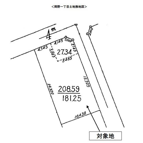
Land area 土地面積 | | 208.59 sq m (63.09 tsubo) (Registration) 208.59m2(63.09坪)(登記) |
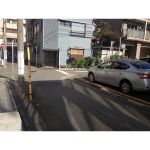
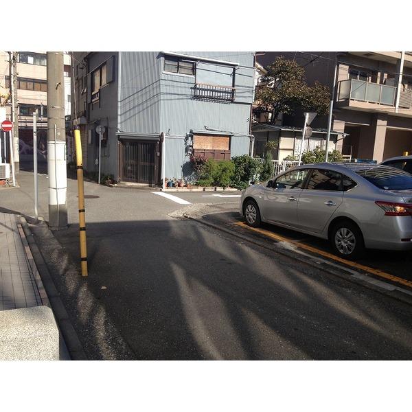
Driveway burden-road 私道負担・道路 | | Nothing, Northwest 4m width (contact the road width 8.7m), Northeast 4m width (contact the road width 15.3m) 無、北西4m幅(接道幅8.7m)、北東4m幅(接道幅15.3m) |
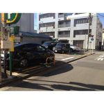
Land situation 土地状況 | | Vacant lot 更地 |
Address 住所 | | Okano, Kanagawa Prefecture, Nishi-ku, Yokohama-shi 1 神奈川県横浜市西区岡野1 |
Traffic 交通 | | JR Tokaido Line "Yokohama" walk 7 minutes
Keikyu main line "Tobe" walk 12 minutes
Sagami Railway Main Line "Hiranuma Bridge" walk 7 minutes JR東海道本線「横浜」歩7分
京急本線「戸部」歩12分
相鉄本線「平沼橋」歩7分
|
Contact お問い合せ先 | | Pitattohausu Yokohama Hama ball bias shop Starts Pitattohausu (Ltd.) TEL: 0800-603-4065 [Toll free] mobile phone ・ Also available from PHS
Caller ID is not notified
Please contact the "saw SUUMO (Sumo)"
If it does not lead, If the real estate company ピタットハウス横浜ハマボールイアス店スターツピタットハウス(株)TEL:0800-603-4065【通話料無料】携帯電話・PHSからもご利用いただけます
発信者番号は通知されません
「SUUMO(スーモ)を見た」と問い合わせください
つながらない方、不動産会社の方は
|
Land of the right form 土地の権利形態 | | Ownership 所有権 |
Time delivery 引き渡し時期 | | Consultation 相談 |
Land category 地目 | | Residential land 宅地 |
Use district 用途地域 | | Residential 近隣商業 |
Other limitations その他制限事項 | | Okano ・ Nishihiranuma district city planning council district (setback: 1.5M than road boundary line) ・ Excite Yokohama 22 district 岡野・西平沼地区街づくり協議地区(壁面後退:道路境界線より1.5M)・エキサイト横浜22地区 |
Company profile 会社概要 | | <Mediation> Minister of Land, Infrastructure and Transport (2) the first 007,129 No. Pitattohausu Yokohama Hama ball bias shop Starts Pitattohausu Co. Yubinbango220-0004 Kanagawa Prefecture, Nishi-ku, Yokohama-shi Kitasaiwai 2-2-1 Hama ball bias the third floor <仲介>国土交通大臣(2)第007129号ピタットハウス横浜ハマボールイアス店スターツピタットハウス(株)〒220-0004 神奈川県横浜市西区北幸2-2-1 ハマボールイアス3階 |