|
|
Nagano Prefecture Kitasaku-gun Miyota-machi
長野県北佐久郡御代田町
|
|
Shinano Railway "Miyota" car 2.3km
しなの鉄道「御代田」車2.3km
|
|
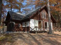
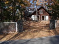
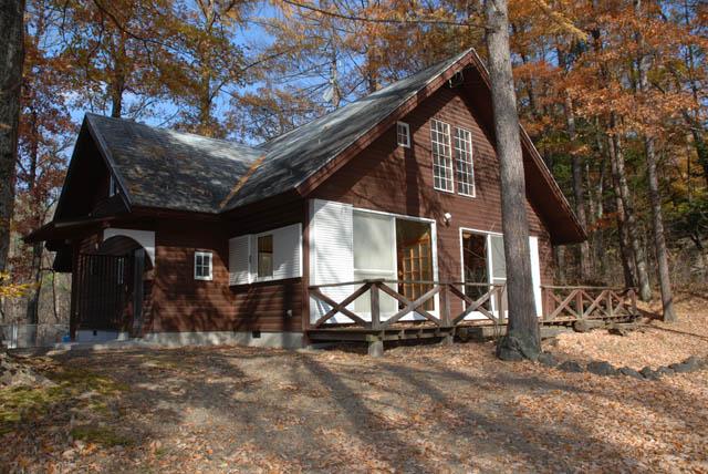
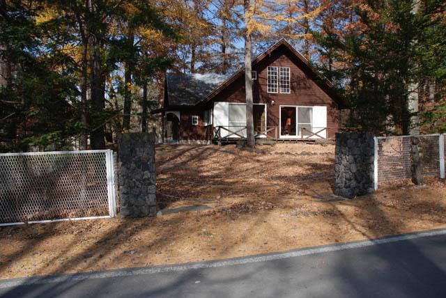
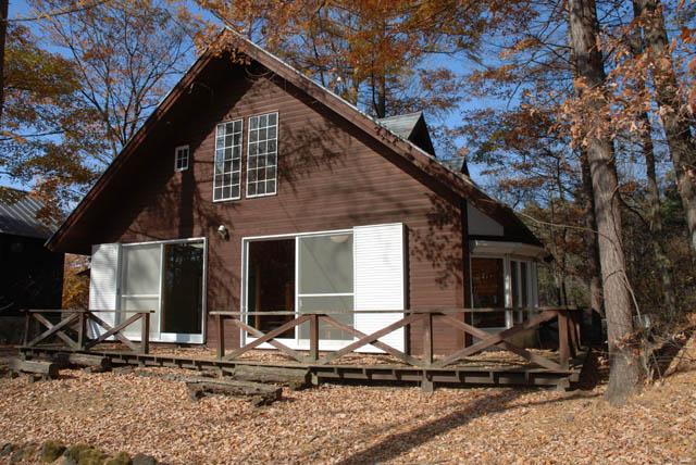
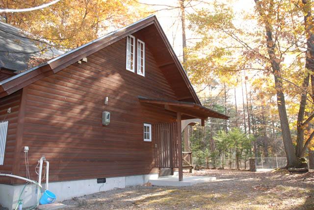
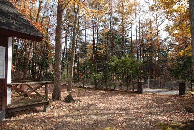
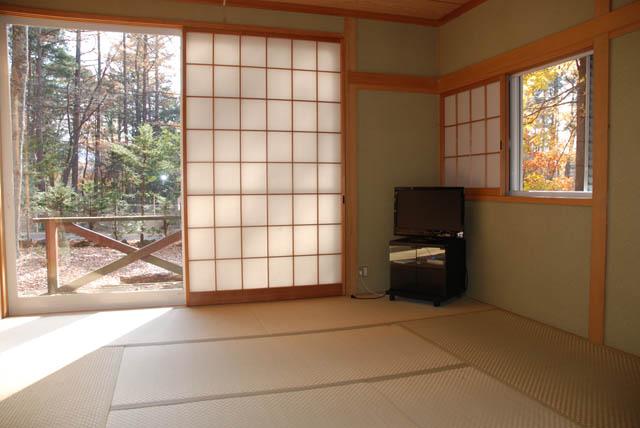
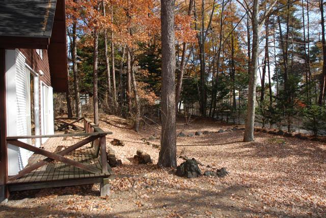
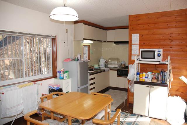
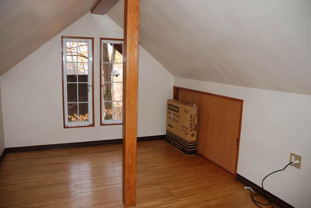
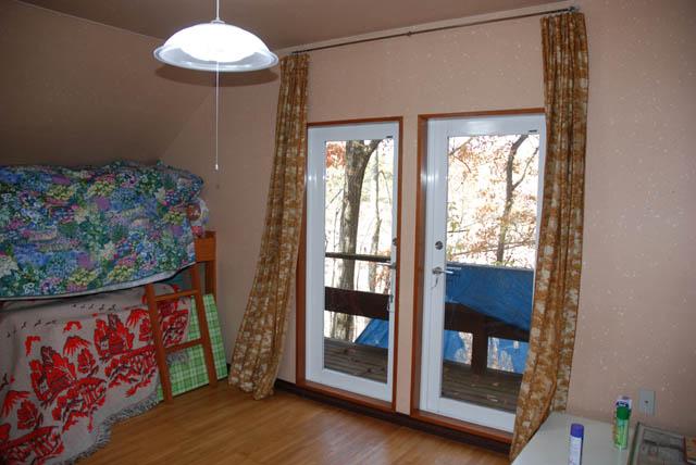
2km until junior high school ・ Sunshine ・ 交便 good ・ quiet ・ MidoriFukashi ・ Floor Heating Yes ・ This sewage ・ Yu Furuya ・ Building unregistered
中学校迄2km・日照・交便良・閑静・緑深・床暖房有・本下水・古家有・建物未登記
|
|
Curling Hall nearby ・ Yukimadomizuumimade 1.2km ・ South Elementary School, Hospital until 1.5km
カーリングホール至近・雪窓湖迄1.2km・南小学校、病院迄1.5km
|
Features pickup 特徴ピックアップ | | Land more than 100 square meters / Immediate delivery Allowed / It is close to the city / Summer resort / Yang per good / A quiet residential area / Around traffic fewer / Or more before road 6m / Shaping land / No construction conditions / Leafy residential area / Flat terrain 土地100坪以上 /即引渡し可 /市街地が近い /避暑地 /陽当り良好 /閑静な住宅地 /周辺交通量少なめ /前道6m以上 /整形地 /建築条件なし /緑豊かな住宅地 /平坦地 |
Price 価格 | | 26 million yen 2600万円 |
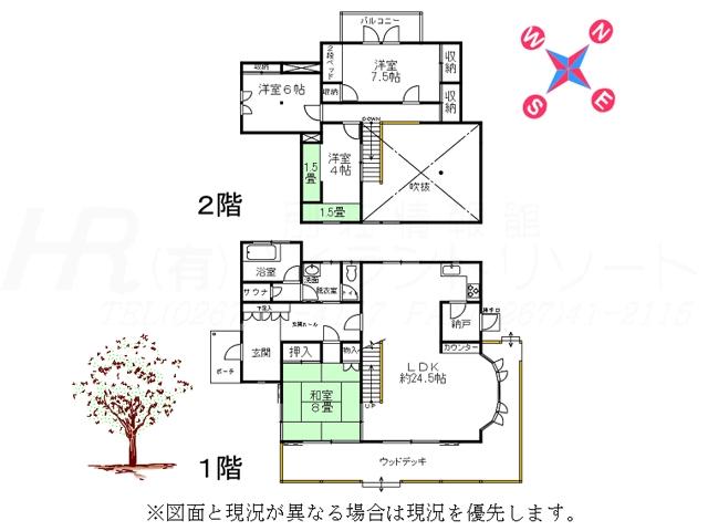
Building coverage, floor area ratio 建ぺい率・容積率 | | 20% ・ 80% 20%・80% |
Sales compartment 販売区画数 | | 1 compartment 1区画 |
Land area 土地面積 | | 889 sq m (registration) 889m2(登記) |
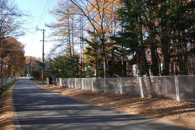
Driveway burden-road 私道負担・道路 | | Nothing, Southeast 8m width (contact the road width 31m) 無、南東8m幅(接道幅31m) |
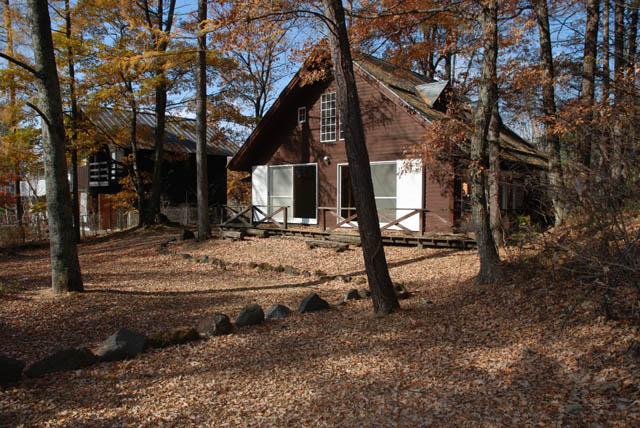
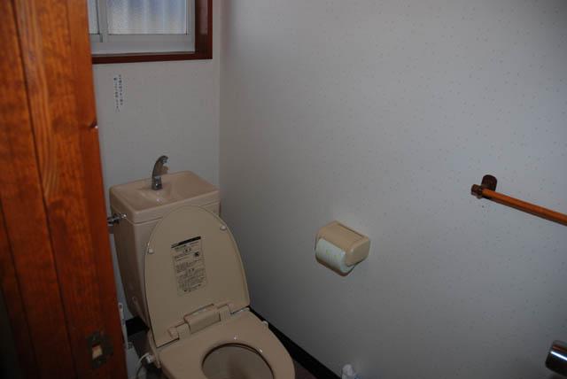
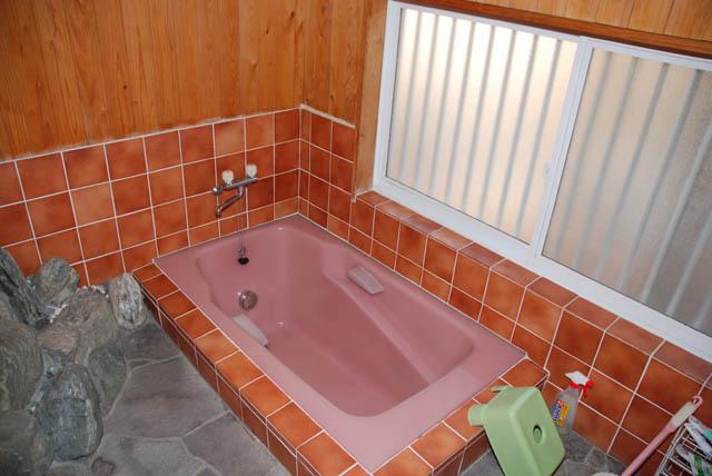
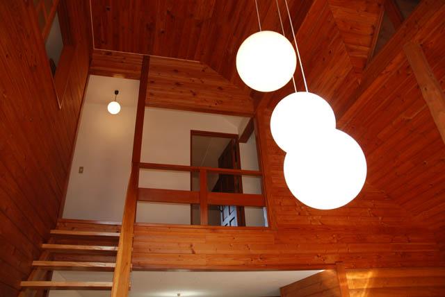
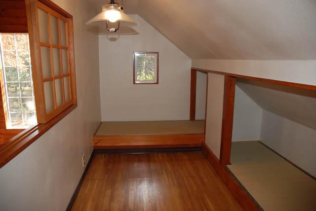
Land situation 土地状況 | | Furuya There 古家有り |
Address 住所 | | Nagano Prefecture Kitasaku-gun Miyota-cho Oaza Miyota 長野県北佐久郡御代田町大字御代田 |
Traffic 交通 | | Shinano Railway "Miyota" car 2.3km しなの鉄道「御代田」車2.3km
|
Related links 関連リンク | | [Related Sites of this company] 【この会社の関連サイト】 |
Contact お問い合せ先 | | TEL: 0800-600-8109 [Toll free] mobile phone ・ Also available from PHS
Caller ID is not notified
Please contact the "saw SUUMO (Sumo)"
If it does not lead, If the real estate company TEL:0800-600-8109【通話料無料】携帯電話・PHSからもご利用いただけます
発信者番号は通知されません
「SUUMO(スーモ)を見た」と問い合わせください
つながらない方、不動産会社の方は
|
Land of the right form 土地の権利形態 | | Ownership 所有権 |
Time delivery 引き渡し時期 | | Immediate delivery allowed 即引渡し可 |
Land category 地目 | | Wilderness 原野 |
Use district 用途地域 | | One low-rise 1種低層 |
Other limitations その他制限事項 | | Scenic zone 風致地区 |
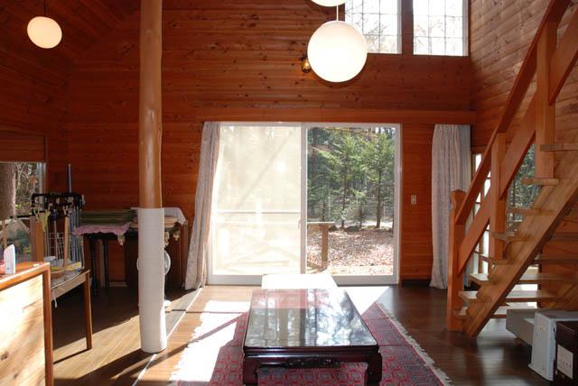
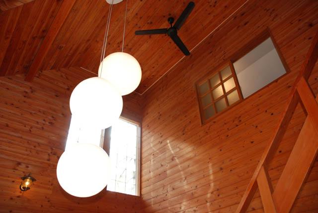
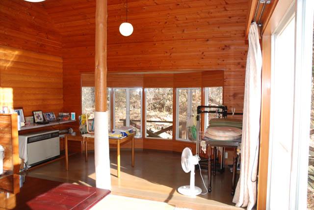
Overview and notices その他概要・特記事項 | | Facilities: Public Water Supply, This sewage, Individual LPG 設備:公営水道、本下水、個別LPG |
Company profile 会社概要 | | <Mediation> Nagano Prefecture Governor (5) No. 004190 (with) Highland Resort Yubinbango389-0111 Nagano Prefecture Kitasaku-gun Karuizawa Oaza Nagakura shaped Narusawa 10-91 <仲介>長野県知事(5)第004190号(有)ハイランドリゾート〒389-0111 長野県北佐久郡軽井沢町大字長倉字成沢10-91 |