|
|
Setagaya-ku, Tokyo
東京都世田谷区
|
|
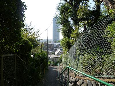
Oimachi Line Tokyu "Kaminoge" walk 9 minutes
東急大井町線「上野毛」歩9分
|
|
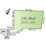
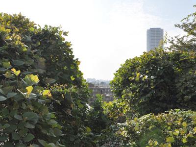
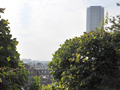
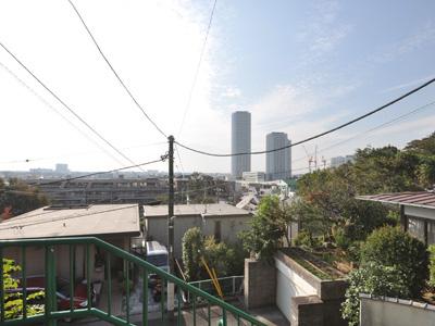
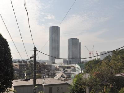
View good land of southwest Hanaredan of Kokubunji cliff line
国分寺崖線の南西離壇の眺望良好な土地
|
|
■ Kaminoge nature park adjacent ■ There is no building conditions ■ View overlooking the Mount Fuji
■上野毛自然公園隣接■建築条件はありません■富士山を望む眺望
|
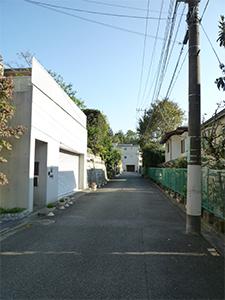
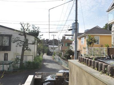
Features pickup 特徴ピックアップ | | Land 50 square meters or more / See the mountain / Super close / A quiet residential area / Around traffic fewer / Idyll / Leafy residential area / Mu front building / Good view / Located on a hill / Fireworks viewing 土地50坪以上 /山が見える /スーパーが近い /閑静な住宅地 /周辺交通量少なめ /田園風景 /緑豊かな住宅地 /前面棟無 /眺望良好 /高台に立地 /花火大会鑑賞 |
Price 価格 | | 228 million yen 2億2800万円 |
Building coverage, floor area ratio 建ぺい率・容積率 | | 40% ・ 80% 40%・80% |
Sales compartment 販売区画数 | | 1 compartment 1区画 |
Land area 土地面積 | | 780.98 sq m (registration) 780.98m2(登記) |
Driveway burden-road 私道負担・道路 | | Nothing, Southwest 5.4m width (contact the road width 4.9m) 無、南西5.4m幅(接道幅4.9m) |
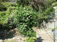
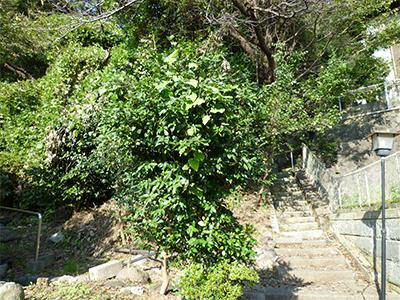
Land situation 土地状況 | | Furuya There 古家有り |
Address 住所 | | Setagaya-ku, Tokyo Kaminoge 2 東京都世田谷区上野毛2 |
Traffic 交通 | | Oimachi Line Tokyu "Kaminoge" walk 9 minutes
Denentoshi Tokyu "Futakotamagawa" walk 12 minutes
Oimachi Line Tokyu "roar" walk 19 minutes 東急大井町線「上野毛」歩9分
東急田園都市線「二子玉川」歩12分
東急大井町線「等々力」歩19分
|
Person in charge 担当者より | | Responsible ShaHara Yuji 担当者原裕二 |
Contact お問い合せ先 | | TEL: 0800-603-0389 [Toll free] mobile phone ・ Also available from PHS
Caller ID is not notified
Please contact the "saw SUUMO (Sumo)"
If it does not lead, If the real estate company TEL:0800-603-0389【通話料無料】携帯電話・PHSからもご利用いただけます
発信者番号は通知されません
「SUUMO(スーモ)を見た」と問い合わせください
つながらない方、不動産会社の方は
|
Expenses 諸費用 | | Town council fee: unspecified amount 町会費:金額未定 |
Land of the right form 土地の権利形態 | | Ownership 所有権 |
Time delivery 引き渡し時期 | | Consultation 相談 |
Land category 地目 | | Residential land 宅地 |
Use district 用途地域 | | One low-rise 1種低層 |
Overview and notices その他概要・特記事項 | | Contact: Yuji Hara, Facilities: Public Water Supply, This sewage, City gas 担当者:原裕二、設備:公営水道、本下水、都市ガス |
Company profile 会社概要 | | <Mediation> Minister of Land, Infrastructure and Transport (6) No. 004372 (Corporation) metropolitan area real estate Fair Trade Council member (Ltd.) Ken ・ Corporation housing sales department Yubinbango106-0031 Tokyo, Minato-ku, Nishi-Azabu 1-2-7 <仲介>国土交通大臣(6)第004372号(公社)首都圏不動産公正取引協議会会員 (株)ケン・コーポレーション住宅営業部〒106-0031 東京都港区西麻布1-2-7 |